


20 random programs from the category
-
in Games
 Каждая из книжек проекта Color by Numbers посвящена одной тематике (цветам, животным, автомобилям, принцессам и др...). В каждой книжке имеется музыкальное и звуковое сопровождение, а так же по двадцать рисунков для раскрашивания, рисунки могут быть раскрашены тремя способами...
-
in Geography
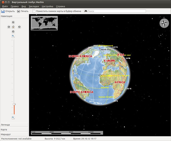 Marble - приложение для просмотра карт. Marble работает с несколькими различными форматами данных, включая OSM, а также с рядом специализированных карт, в том числе с историческими картами начиная с 1700-х годов, спутниковыми изображениями Земли, с картами распределения температур и осадков, и даже с картами Луны и Венеры.
В Marble карты, которые подразделяются по "темам", изображаются по умолчанию в сферической проекции. Пользователи могут переключаться в планарную проекцию или проекцию Меркатора, если это предпочтительно. Если подключены плагины Photos и Wikipedia, то в дополнение к отображению картографических данных, в Marble можно также отображать фотографии, имеющие метку местоположения, или статьи Википедии, связанные с определенным местоположением
-
in Design
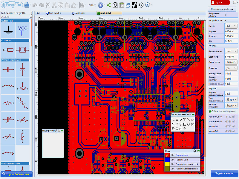 EasyEDA - electronics design automation environment. It is perfect for both electronic engineers and teachers, students and radio amateurs.
It has wide possibilities for the development of printed circuit boards and modeling due to the use of huge libraries of electronic components for circuits, printed circuit boards and simulation.
Includes:
-
in Programming
Программное обеспечение основано на debhelper, dpkg-buildpackage и других хорошо испытанных инструментах. Вы можете попробовать собрать простой пакет из архива с некоторых GNU-пакетов программного обеспечения, содержащего меньшие Makefile и конфигурационные скрипты. В будущем дополнении сможет выполнять еще больше функций.
Обратите внимание: вам не нужны особые знания структуры пакетов для использования этого приложения.
-
in Mathematics
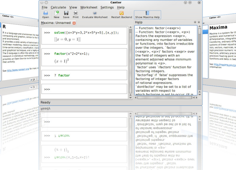 Приложение, которое позволяет использовать математические приложения Sage, Maxima, KAlgebra с единым интегрированным интерфейсом.
Оно предлагает диалоги помощи для выполнения общих задач и позволяет делиться своими результатами работы с другими.
Основные функции:
✔Создание таблиц для вычисления выражений;
✔Открытие результатом вычислений в отдельном окне или вкладке;
✔Наличие плагинов для подключения различных библиотек;
✔Ввод формул с использованием LaTeX;
✔Подсветка синтаксиса.
-
in Science
 AWeather - это продвинутая программа для работы с прогнозами погоды. Это не просто иконка в трее, которая показывает текущий прогноз, а программа, имеющая множество возможностей для работы с прогнозами и простой пользовательский интерфейс.
-
in Programming
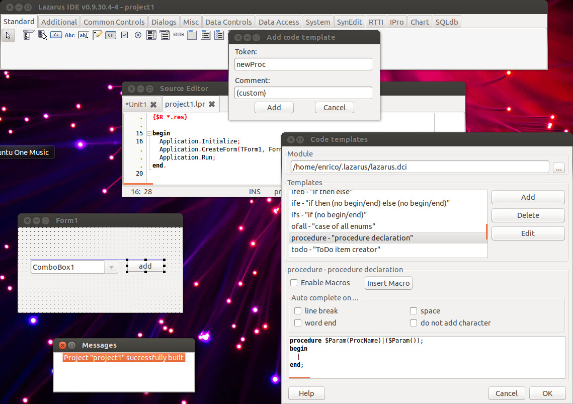 Lazarus is an integrated cross-platform software development environment in a Delphi-like environment in the Object Pascal language for the Free Pascal Compiler (often abbreviated FPC).
It is currently the only Rapid Application Development (RAD) tool that allows Delphi programmers to create GUI applications for Linux (and other non-Windows) systems.
Allows you to easily transfer Delphi programs with a graphical interface to various operating systems: Linux, FreeBSD, Mac OS X, Microsoft Windows, Android.
-
in Learning
 KTouch - это обучающая программа для повышения скорости печати и сокращения ошибок. Она выдает для набора специальный текст и показывает, какой палец должен быть использован для каждой клавиши.
Возможности программы:
- Поддержка различных раскладок клавиатур.
- Возможность добавления новой раскладки.
- Редактирование упражнений.
- Детальная статистика по результатам выполняемых упражнений.
- Подсчёт скорости и качества(аккуратности) печати.
- Различные цветовые схемы интерфейса
-
in Programming
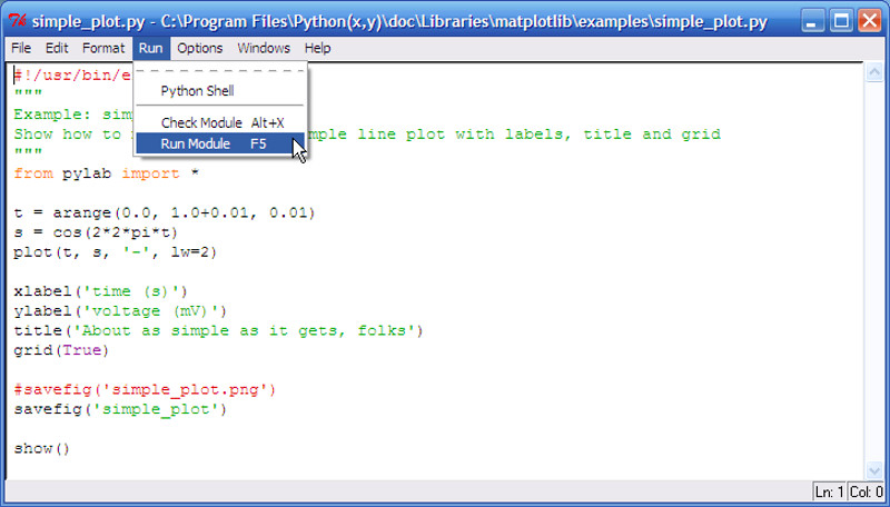 IDLE is an Integrated Development Environment for Python.
IDLE is written using Tkinter and is therefore available on different operating systems.
-
in Programming
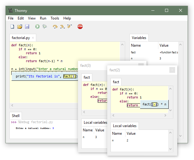 Thonny is a simple Python IDE with features useful for learning programming.
It comes with a debugger which is able to visualize all the conceptual steps taken to run a Python program (executing statements, evaluating expressions, maintaining the call stack). There is a GUI for installing 3rd party packages and special mode for learning about references.
UALINUX LTD.
Write: - to Viber - to WhatsApp - to Telegram
Call: +380 (97) 33-55-1-88 (пн ... пт 10.00 - 17.00) (GMT+2)
E-Mail: [email protected]

![]()
![]()